|
|
|
|

| Jun 2, 1688 - Oct 11, 1799 | Peter Schuyler | x acres |
| Oct 11, 1799 - Mar 9, 1700 | Jochem Staats | x acres |
| Mar 9, 1700 - 1712 | Dirck Vanderburgh | x acres |
| 1712 - 1771 | Henry Vanderburgh and heirs | x acres |
| 1751-1771 | Henry Livingston, Sr. | 385 acres |
| 1771 - 1830 | Henry Livingston, Jr. | 385 acres |
| 1830 - 1847 | John B. Montgomery | 250 acres |
| 1847 - 1900 | S.F.B. Morse and sons | 100 acres |
| 1900 - 1985 | William Young | 76 acres |
| 1985 - current | Locust Grove, the S.F.B. Morse Historic Site | 150 acres |
|
|
|
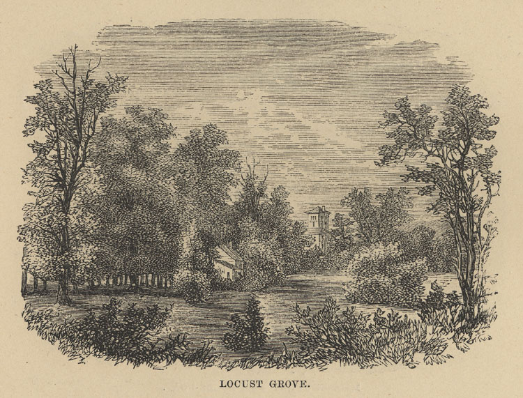
Locust Grove lies on the east bank of Henry Hudson's great river and it is worth noting that the first written reference made by white men to this particular vicinity is found in the Journal that was kept by Robert Juet, the mate of the Half Moon, when that vessel came up the river under the command of Henry Hudson. Eight days from today it will be three hundred and twenty-three years since Robert Juet on September 29, 1609, recorded the passage of the Half Moon through what he called "the Long Reach," by which he meant the straight channel for sailing that lies between our New Hamburgh and our Hyde Park. Locust Grove looks out on the waters of "the Long Reach" and the name and the place link us in thought with Henry Hudson and his times.
Of course it goes without saying that the land which constitutes Locust Grove once belonged to the Indians. They were the
|
|
|
|
Buying this tract on speculation, Colonel Schuyler sold it ultimately in three nearly equal divisions. One of the three divisions he
conveyed on October 11, 1699, to Jochem Staats of Albany, the site of Locust Grove being covered by the deed. Jochem
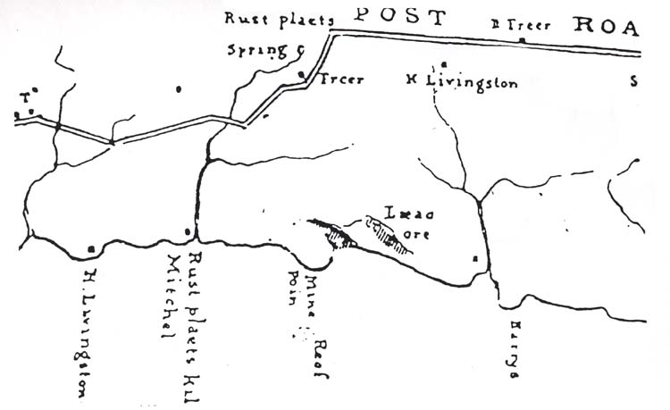
Staats thus acquired from Colonel Schuyler a tract which fronted the river from (approximately) Mine Point to Rudco, its boundaries being
two streams, - one at the north, called Apokeepsing (which flows now through the Poughkeepsie Rural Cemetery); and one
at the south which we know as the Speckenkill but which originally was "Speck zyn kill." |
|
|
||
Around 1696, Dirck began acquiring large parcels of land along the Hudson River. He petitioned for license to purchase lands in Westchester, Orange, Ulster, and Dutchess Counties, and in Albany County "upon Schenectady River." On 2 Nov 1696, he received a division of the original Schuyler Patent from Caleb Heathcote described as "a tract or parcel of ground; scituate, lying and being within Dutchess County in the Province of New York; being one quarter or equal fourth part; 50 acres thereof being first deducted of all that a certain tract or parcel of ground; lying in Dutchess County aforsaid; on the east side of Hudson's River; containing, in the whole, in length along the said river, six miles or thereabouts; bounded on the south by a creek called John Casper's creek; on the north by the land of the said Robert Sanders and Myndert Hermonson; west by Hudson's River aforesaid; and east by the land of Henry Cuyler and Col. Stephanus Van Courtlandt."
On 9 March 1699/1700, he also received from Jochem Staats another large tract
of the Schuyler Patent in Dutchess County. This tract is described as "All that one fourth
of a piece or parcel of land, situate, called the LONG RACK: beginning at the south end
from a Creeke [Specken Kill] (which runs out of the Creek called Jan Casperses to the
north of the land now in possession of Peter Lassing); and Runns northward, up along
side river, to another Creek, known and called by the name of the RUST PLAETS or, by
the Indians, APOPEESING, where trees stand marked, slanting over to JUFFU HOOK:
and strikes eastward into the woods to the said Jan Casperses Creek, which runs
southward along the east Syde of said land to the first Creek named."
On 7 Nov 1701, Dirck styled himself "of Dutchess County." This indicates that
Dirck had decided to relocate from New York City to the Schuyler Patent lands he had
purchased on 2 Nov 1696 and 9 Mar 1699/1700. His other land purchases were
apparently speculative investments. There is a strong possibility that Dirck had actually
moved to Dutchess County by the time he died in early Sep 1709. The Lutheran Burial
Records of New York City state: "1709, beginning of September, died, suddenly on his
plantation in the Highland, Schillyck, Dirck Van der Burgh about 48 years old. Was
thereupon buried on his plantation." This "plantation" was probably Dirck's portion of
the Schuyler Patent that passed to his son [Henry] and daughter [Mary Ann].
Before Francina Leisler, the daughter of the Jacob Leisler who was hanged in 1691 and Elsie Thymens, was married to Jochem Staats, she was married to Thomas Lewis (born 1674), who was the uncle of the Thomas Lewis who married Dirck Vanderburgh's daughter Anna Maria Vanderburg. So the property of Jochem Staats was sold to a family connection. The older Thomas Lewis was the brother of Catherine Lewis, the wife of Peter Baltus Van Kleeck. Catherine and Peter were the parents of Trijntien (Catharine) Van Kleeck, the wife of Bartholomew Crannell and mother-in-law of Henry's brother Gilbert. Another sister of Thomas and Catherine was Jacoba Lewis, who was the wife of Lawrence Lawrence Van Kleeck and the grandmother of Dr. Baltus "Lawrence" Van Kleeck, the husband of Henry's first cousin, Cornelia Livingston, the daughter of his uncle James. A son of that same uncle James was Gilbert James Livingston, who married Susannah Lewis, the granddaughter of Thomas Lewis and Anna Marie Vanderburgh, as well as Henry Hendrick Vanderburgh and Sarah Van Kleeck. The Crannells property was taken by the Revolutionary government for siding with the British. So was that of Thomas Lewis.
Henry's sister Cornelia was married to Myndert Van Kleeck, also called Lawrence Van Kleeck, but his connection within the Van Kleeck family has not yet been settled. So though the Locust Grove land was not passing directly through family when it passed from Jochem Staats to Dirck Vanderburgh to Henry Livingston, Sr., it was certainly passing through family connections. |
|
|
|
Henry Van Der Burgh removed from New York in early manhood and established himself on this portion of his father's lands. He played a leading part as a pioneer in the development of the local community and brought up a large family of sons and daughters in a house that stood on the east side of the then King's Highway (now the state road), close to the spot where at present there is a house owned by John Van Benschoten.
Henry Van Der Burgh's acres bordered both sides of the King's Highway for some distance north and south of where we stand today
at Locust Grove.
Henry and Anna Mary, his sister, inherited large portions of land in Orange, Ulster, and Dutchess counties from their father. On 19 Apr 1716, Henry and Anna Mary, the wife of Thomas Lewis, divided up the inherited property. The property was generally divided from North to South. Henry's portion abutted the Hudson River to the West. Thomas Lewis' portion abutted Henry Vanderburgh's land on the West and Casper's Creek on the East. In modern times the property extended along the Hudson River from where the Poughkeepsie Rural Cemetery is now located to about Spackenkill Road and then eastward toward Cedar Avenue. Having made the property settlement with his sister and her husband, Henry made his permanent home in the section of the Schuyler Patent that extended from the "Rust Plaets" to "Speck zyn kil." The "Rust Plaets" bounded Henry's East-West property line on the North. His northern adjoining neighbor was Myndert Harmse. By 1742, John Concklin had replaced Myndert as the northern neighbor. Henry's house stood about 385 feet South 68 degrees West from the spring from which the "Rust Plaets" stream originated. This spring had long been used as a gathering place by the Indians. The stream that flowed from the spring was called "apokeepsinck" (many spelling variations). From the Indian name of this stream, the word "Poughkeepsie" evolved. With the Dutch settlement in the late 1600s and early 1700s the spring retained its importance. The Dutch called the stream coming from the spring the "Rust Plaets Kil." Its close proximity to where Henry Vanderburgh settled aids in defining the location of his house. The positive identification of the Rest Place was an issue in the first half of the 18th century. In 1742, Johannis Van Kleek, age 62, and Myndert Van Den Bogart, age about 60 appeared before Francis Filkin, a Judge of the Inferior Court of Common Pleas for Dutchess County. They made a statement regarding the identification of the area south of Poughkeepsie known as the "Rust Place." The occasion of these declarations probably concerned a boundary dispute between Jacob Low and Henry Vanderburgh: "Declared that the Rust place (which Bounds Mr. Henry Van Den Burgh & compy on the North & Myndert Harmse and Company on the South according to a deed given them by Coll. Peter Schuyler which lays and is on ye East side of Hudsons River (Slanting over against Juffrows hook) and lays in poghkeepsie precinct is at a small fall of water where stands a Black Ash Stump Sprouted & a pepprige Stump Sprouted Both standing on the Little fall and a large stone on the fall. Little fall is about seven yards to the Southward of a Birtch Stump standing between large stones or rocks the said Deponents positively say that this discribed place is the only rust place and which was meant in said Schuylers deed and that there is no other in said pattent: the said Rust Place is now. in the open field & in the fence of Richard Van Den Burgh and the said Rust Place is about twenty five yards to the Southward of John Concklin’s fence and the said Johannis Van Kleek saith that he hath knowne the said discribed place called the Rust place to be knowne by that Name fifty years ago and the said Myndert Van Den Bogart saith that he hath also knowne the said discribed place called the Rust place to be knowne & called by the name Rust Place fifty years ago and further say not." The "Rust Place" was an important demarkation point. "The northern and middle portions of Colonel Schuyler's patent were divided, when sold, by a line that ran east and west through the Rust Plaets and the Rust Plaets "slanted over to Juffrouw's Hook." The land that lies north of this dividing line and south of the Rust Plaets Kil (comprising most of the southern end of the Poughkeepsie Rural Cemetery) passed by a succession of transfers under Schuyler to Jacob Low, whose ownership of it occurred during a period which there was a long-drawn-out legal struggle taking place in Ulster County to determine the exact location on the west shore of the Hudson of the southeast corner of the New Paltz Patent. The two places under dispute were half a mile apart; one was opposite to Mine Point, the other further south. The Rust Plaets "slanted over to Juffrouw’s Hook" and Juffrouw's Hoeck was the southeast corner of the New Paltz Patent so Jacob Low (who came from Kingston and was familiar, presumably, with Ulster County affairs) saw that, if the "slant" from the Rust Plaets was toward a point on the west shore half a mile farther south than was Mine Point on the west shore, he could claim an extra gore of land below Mine Point. Which he accordingly did. By making the claim he encroached upon his next neighbor to the south, Henry Van Der Burgh. Henry brought suit against Low in the Dutchess County Court for trespass: "Jacob Low vs. 1747 Poughkeepsie Rcd, trespass Henry Vanderburgh & theft of lumber 17 Oct 1747. Before John TenBrook, a Dutchess County Justice of the Peace, in Poughkeepsie, came Henry Van Den Burgh and complained against Jacob Low for that he in force and arms on 13 Oct 1747 entered the close and land of him the said Henry and his woods and Timber there [ ] growing to the value of five pounds or [ ] Did cut Down and Carry away against the peace and to his damage five pounds aforesaid at which said Day the said Jacob Low also appeared before me and pleaded the place where the said portented trespass was said to be comitted was at the Time of the said trespass pretended to be comitted the soil and freehold of the said Jacob and the said plantiff saith that at the same time it was not the freehold of him the said Defendant and this he prays may be inquired of by the County and the Defendant in like manner wherefore. Confirming this suit is an undated map endorsed "Jacob Low’s Farm on Tryall" and made out in the handwriting of Henry Livingston, Sr. This map shows the place where "the trespass was committed." 18 Low bought the farm in 1727 and sold it in 1751. The dispute ended favorably for Henry, for the gore remained in his possession. The "Tryall" map contains a key point that helps determine the location of Henry Vanderburgh's house. The map identifies a white oak tree marking a common boundary point for Low and Vanderburgh. The distance and direction from the white oak to the Rest Place is defined as North 88 degrees East, 7 chains and 32 links. Many Dutchess County deeds make reference to this particular white oak, but fail to mention its location and distance relative to the Rust Place. Helen Wilkinson Reynolds, in her "Poughkeepsie, The Origin and Meaning of the Word," (Collections of the Dutchess County Historical Society, Vol. I, 1924), dated the map between 1737 and 1751. The map can probably be more specifically dated at 1751 for several reasons. The date of 1751 corresponds with the start of Magdalena Vanderburgh selling off portions of her husband's former estate. Henry had died during the previous year. Her first transaction conveyed 57 1/2 acres in the disputed tract to Henry Livingston, Sr. Henry Livingston, Sr. was certainly knowledgeable of the dispute since the map is in his handwriting and he ultimately became the owner of the land in question. Another important point is the statement written on the map which says: "Jacob Low's Bounds According to Van Der Burgh's wife." There is a strong implication here that the map had been drawn after Henry Vanderburgh's death, otherwise, Henry Vanderburgh himself would have been the person quoted on the map. With the Rust Place and white oak tree as reference points, an examination of Dutchess County deeds helps narrow the location of the house. In the conveyance of the 57 1/2 acres to Livingston (deed 3:78-82), the location of Henry Vanderburgh's house is referenced: Beginning ... "At a rock and heap of stones standing on a line run West from a White Oak Tree standing about North West about sixty yards from Henry Vanderburghs house to Hudson River." Later in the deed, another reference is made to the house: Beginning again at the rock and heap of stones, then South 28 chains to a black oak sapling ... standing about 80 yards "to the Westward of the valley coming from the Old Dwelling House ..." 20 In deed 7:127-140, 18 Oct 1771, Henry Livingston, Sr. conveyed the same parcel to his son, Henry Livingston, Jr. The description of the location of Henry Vanderburgh's house in this deed is exactly the same as that given in deed 3:78-82. In deed 11:361, 27 May 1751, Jacob Low conveys to John Crooke a parcel at or near Poughkeepsie that began at a white oak, some distance South East of the King's Highway and is the parting bounds of Jacob Low, Henry Vanderburgh and John Concklin. From the description of the rest of the property in this deed, this is the same white oak mentioned in deed 3:78. From the "Tryall" map and deed 11:361 we know that a white oak tree marked a common boundary point for Vanderburgh, Low, and Concklin. Also, from the "Tryall" map we know that this white oak tree was 484 feet, South 88 degrees West from the Rest Place. If the directions in deeds 3:78-82 and 7:127-140 are taken literally, ie. the white oak tree stood exactly North West from Henry Vanderburgh's house about 60 yards, then we know that the house stood about South 45 degrees East 180 feet from the white oak tree.
Completing a triangulation among the house, white oak, and the Rest Place, Henry
Vanderburgh's house would have been approximately South 68 degrees West 385 feet
from the Rest Place.
The present day "Rust Plaets" and site of Henry Vanderburgh's home exists to the
East of US Route 9 and to the North and West of Sharon Dr. in the town of
Poughkeepsie.
Henry had an extensive farm that once comprised a thousand acres. Records of 4 June 1731 show that the ear mark for his mares, neat cattle, sheep and hogs was a "roundish hole in the right eare." His horses and colts were branded with a Greek Cross enclosed within a circle. In 1737, Henry appeared in the Dutchess County Inferior Court of Common Pleas seeking help in collecting a debt of eight pounds from William Squire. On 28 Feb 1736/7, Henry filed an indebtedness claim with the court against Squire. On 19 May 1737, the court directed the Dutchess County Sheriff to apprehend Squire and bring him to court on the third Tuesday in Oct 1737 to face the charge. On 21 May, Squires was apprehended and delivered to his bondsman, John Gay, a carpenter. The records are silent on the outcome of the matter. Henry apparently disposed of all of his lands in Orange and Ulster Counties, and part of his lands in Dutchess County before his death. At his death, only land in Poughkeepsie Precinct remained.
Henry was still living in 1747, but apparently died in 1750.
His will had been
made out on 13 Jan 1737/8 and probated on 18 Oct 1750.
In it, he left his entire estate to his wife, Magdalena.
|
|
1751 - 1771 |
|
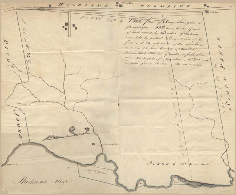
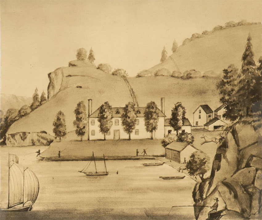 Henry Jr.'s Watercolor of Parents' Estate
On 6 Apr 1751, deed 3:78, she [Magdalena Vanderburg] conveyed 57 1/2 acres of land for
86 pounds and 5 shillings to Henry Livingston. She sold him an additional 37 1/2 contiguous
acres in deed 3:83 on 12 May 1752 for 75 pounds.
Dutchess Co., NY deed 3:83, 12 May 1752; and Map - Henry Livingston's purchase of lands from Henry
Vanderburgh, deceased. LDS microfilm #0930120. Those were the only two direct conveyances that Magdalena made outside her immediate family. Having made those transactions, she was left with an estate of 613 3/4 acres. The property was mapped, surveyed, and divided into nine lots of 68 acres each by Andrew Yelverton. Magdalena died sometime between 1752 and 1772. She and Henry were probably buried in graves in a family burying ground that Henry had established on his own property. In 1924, the area of the burying ground was owned by Dr. A. R. Moffitt.
One of the children receiving equal shares of Magdalena's estate was daughter Mary, the wife of Baltus Van Kleeck.
Mr. Livingston lived in a house
that stood on the bank of the river where the plant of the Phoenix Horseshoe Company was placed in recent times and,
between 1751 and 1767 by nine successive purchases from members of the Van Der Burgh family, he protected himself against
undesirable neighbors immediately to the south of his own home. Finally, he consolidated a number of his purchases into
one large holding and in 1771 made a present of the same to his son, Henry Livingston, Jr., on the occasion of the latter's
marriage.
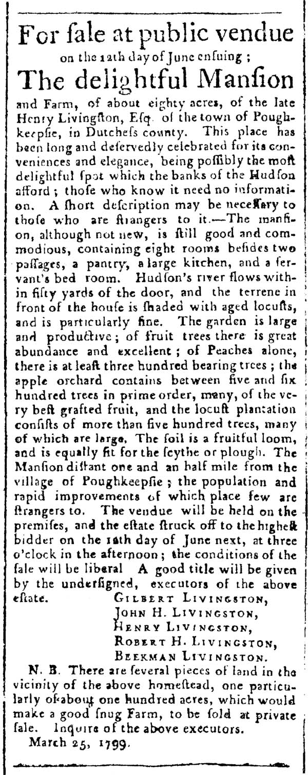 Sale of Henry Sr.'s Estate The ad seems not to have been successful, since Henry Sr.'s home was eventually purchased by his grandson, Colonel Henry A. Livingston, the son of Rev. John Henry Livingston.
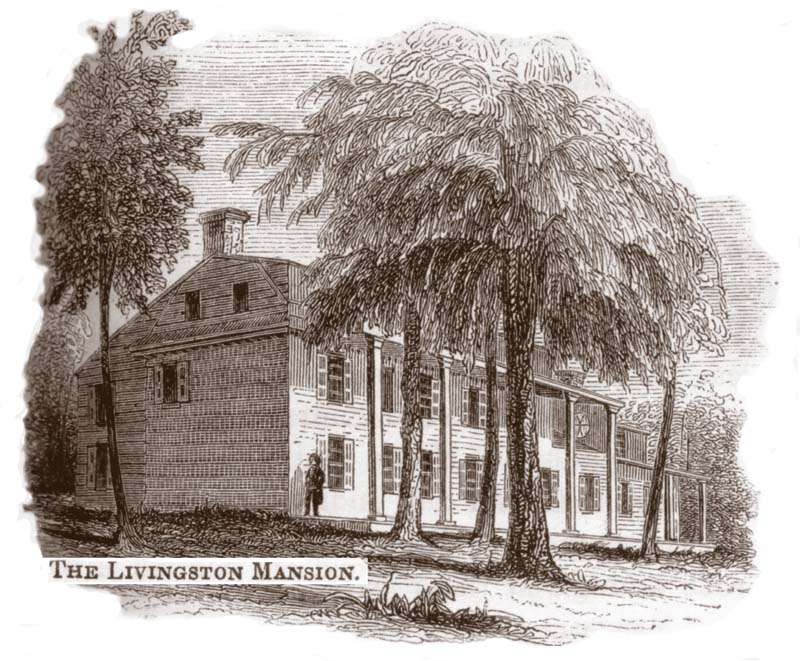 Henry Alexander Livingston on Porch of Henry Sr.'s Former Home The house stayed in the Livingston family until 1870, 128 years, when it became an office for the Phoenix Horseshoe Company. With the creation of the north-south railroad line along the River, the peace of the old place was incessantly broken by the railroad that ran not many feet from the front door.
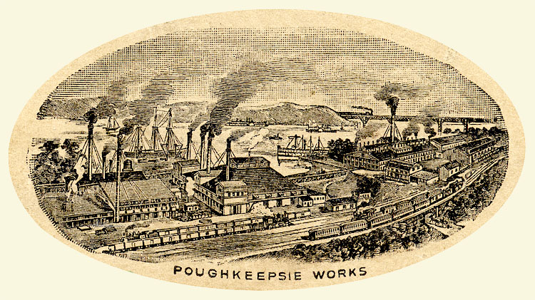 Phoenix Horseshoe Company
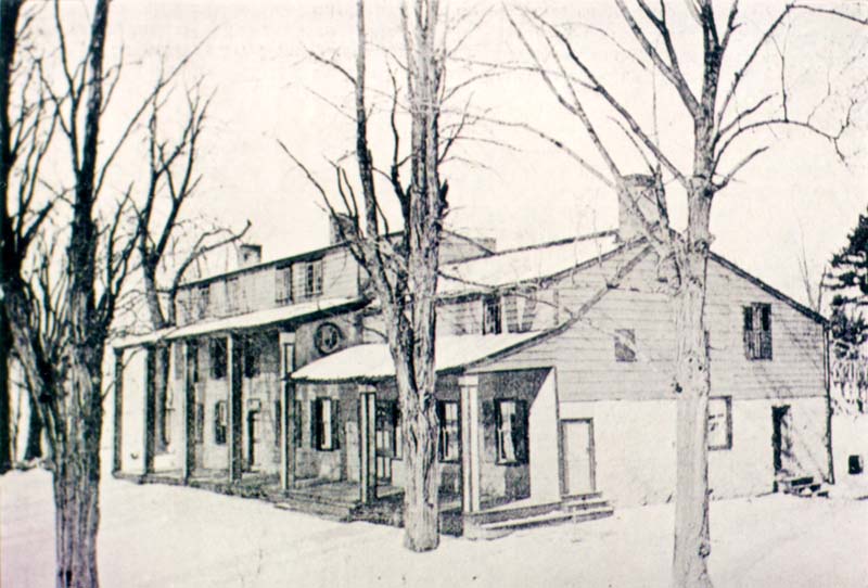
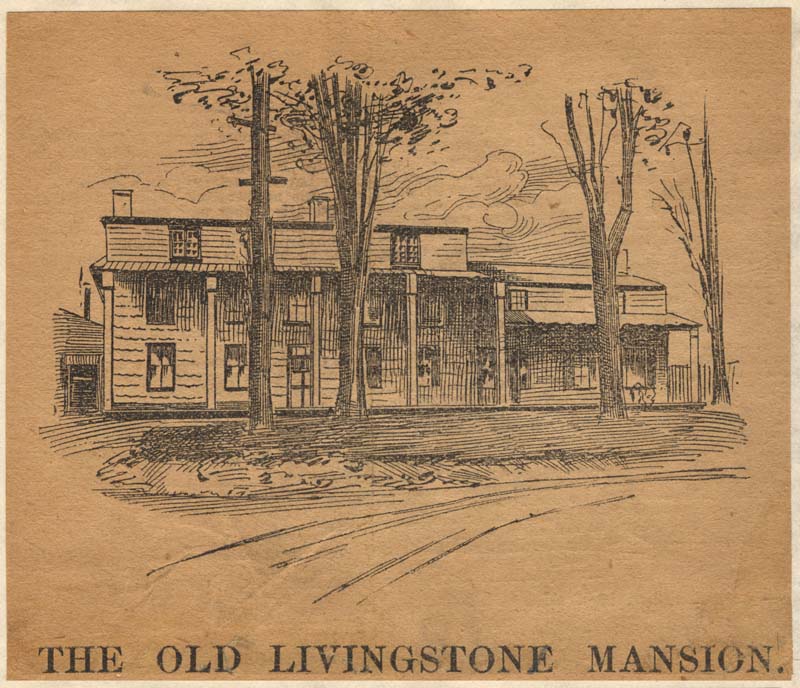 In 1910, the building was finally torn down, though the fireplace mantle built by Henry Alexander Livingston is said to have been donated to the Poughkeepsie DAR. |

|
|
||||
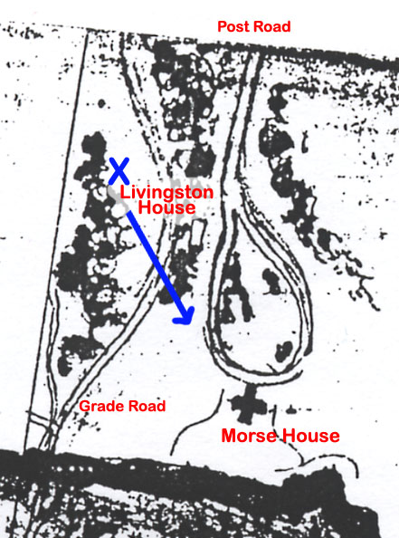
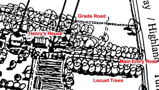
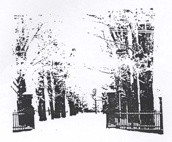
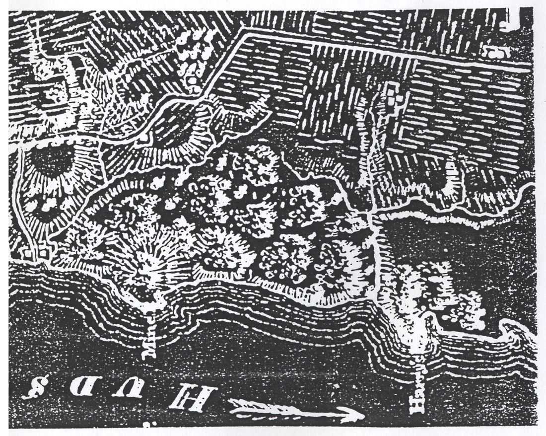
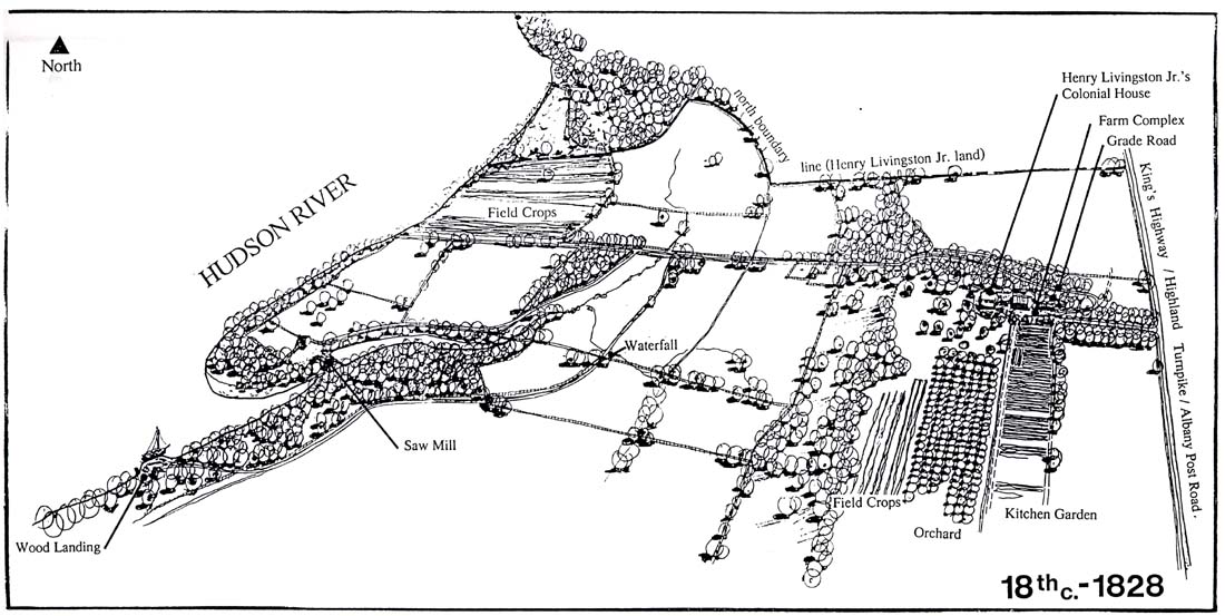
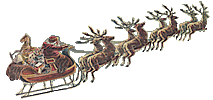
The gift made by Henry Livingston to Henry Livingston, Jr., included the land on which we are now standing and, on the north side of the entrance-drive between this house and the gate, is a spot which is pointed out as the one on which Henry Livingston, Jr., is believed to have built his house about 1771. Henry Livingston, the second, is less well known in Dutchess County than he deserves to be. He was a man who not only served the public in civil and military capacities but who stands out conspicuously in other ways. Beside conducting a mill, a store and a landing for sloops on the shore of the river west of this house (near a promontory known, for him, as: Harry's Point), he was by profession a surveyor and he was gifted with artistic talent. He had a facile pencil, which he used to decorate the borders of his maps and in making sketches, We have him to thank for a sketch made in 1799 of a river-landing and storehouse, - the only picture I have ever found of one of those wharves for sloops with which the water-front of Dutchess was dotted in the eighteenth century. Another delightful drawing is of his own saw-mill here at Locust Grove. Still another, that ornaments a map dated 1798, is of a surveyor's chain, through which is entwined a long spray of a climbing rose. And his fancy was as facile as his pencil for he wrote often and at length genial, merry verses that described family-scenes and current events.
Henry Livingston, the second, gave the name Locust Grove to this place and he lived here from 1771 until his death in 1828, - fifty-seven years.
 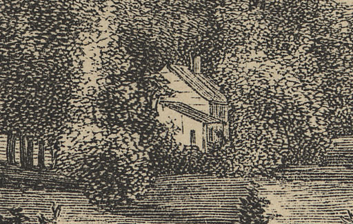
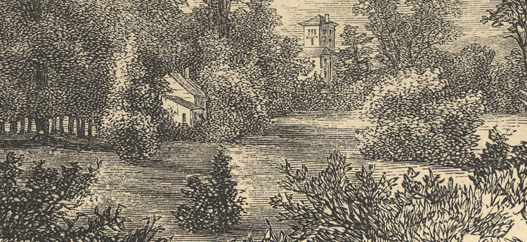
We have only a single picture of Henry Livingston, Jr.'s home, and that not a very good one. The house's narrow end is to the street, but there's been an addition added on that side and the chimney that should be there is not visible. The house was of stone, though probably not the addition, but the etching doesn't bring that out. To the left and right of the house are tall trees that are probably the locust trees described as having given their name to Henry's property. The dormer windows described by Cornelia Goodrich are not shown, which implies that they only appear in the front of the house. There is only a field behind the house, but from the configuration of Henry's house and Morse's, they are probably both off the same driveway which passes to the south of the house. This is consistent with the maps drawn by Henry that show three buildings on that side of the road, and two on the other.
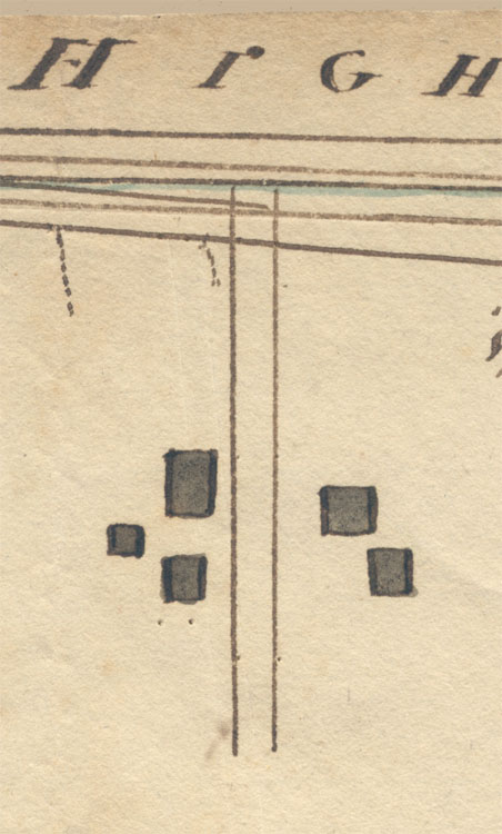 Notice the pinholes in the map. Perhaps they were there to help lay in straight lines and distances. The view of the Van Deusen house below shows a Dutch stone house with shutters, though with its wide side to the street. The dormer windows of this house are in the front. We can get some idea of what Henry's house would have looked like from this house which has so many similar elements.
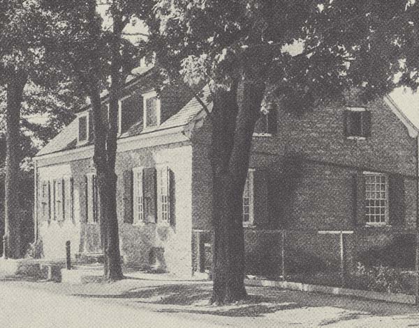 Van Deusen House, Albany There was supposed to be a watercolor picture of Henry Jr.'s house, and possibly a photograph in the possession of Edward Lind Morse. Neither have yet turned up.
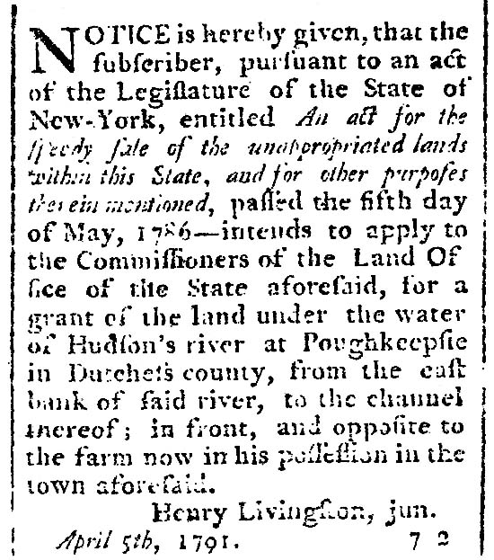 Henry applies for grant of underwater land
|
|
|
||||||||
|
|
![]() Copyright © 2003, InterMedia Enterprises
Copyright © 2003, InterMedia Enterprises


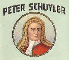 Wapani Indians, or Men-of-the-East-Land, and from them Colonel Peter Schuyler of Albany [Henry Livingston's great uncle]
made a purchase for which, on June 2, 1688, he obtained a patent from the Crown. The land that Colonel Schuyler bought
extended from the present city of Poughkeepsie southward along the river to what is now called Clinton Point (or Stoneco) and
was bounded by the river on the west and by Jan Casper's Kil on the east and south.
Wapani Indians, or Men-of-the-East-Land, and from them Colonel Peter Schuyler of Albany [Henry Livingston's great uncle]
made a purchase for which, on June 2, 1688, he obtained a patent from the Crown. The land that Colonel Schuyler bought
extended from the present city of Poughkeepsie southward along the river to what is now called Clinton Point (or Stoneco) and
was bounded by the river on the west and by Jan Casper's Kil on the east and south.